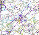
 Map of paths around Coupar Angus - click to open larger version in new window.
 There are lots of paths in the countryside around Coupar Angus. Click on this map to explore Perth & Kinross Council's Core Paths Network. Unfortunately there was a major landslip on the Greenburns path last winter, making it virtually impassable.
The Council's main paths web page is here. It includes a link to a useful Interactive Map, from which the map shown on the right is taken.
The Council's main paths web page is here. It includes a link to a useful Interactive Map, from which the map shown on the right is taken.

 RSS Feed